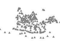
Points showing the main peaks of Belasitsa Mountains, their names and altitude. The datasets contains also points in Greece and Macedonia and the neighbouring Ograzhden Mountain. Extracted from ZEM files, property of Ministry of Agriculture with added field GPS Points.
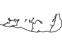
The identified and marked touristic routes in the Bulgarian part of the Belasitsa Mountain during the course of the project "Conservation of the globally important biodiversity of Belasitsa Mountain through involvement of the local people in the developement of the ecotourism" with the financial aid of the Swiss Agency for Developement and Cooperation and the GEF Small Grants Programme.
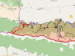
The map represents the main objects of tourist interest in the region of Belasitsa Nature Park. It also contains main marked tourist trails, developed by the efforts of BBF staff - Belasitsa branch and especially those of Latinka Topalova-Rzerzycha. The activities were carried out in the course of project "Conservation of the globally important biodiversity of Belasitsa Mountain through involvement of the local people in the developement of the ecotourism" with the financial aid of the Swiss Agency for Developement and Cooperation and the GEF Small Grants Programme.
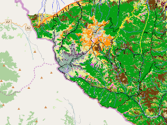
This map represents a summary of a part of the most important results from the biodiversity studies conducted in Osogovo Mountains by the Bulgarian Biodiversity Foundation in the framework of the project Balkan Green Belt in Osogovo. The project was financed by the Frankfurter Zoological Society and ProNatura, Switzerland in the time period 2007-2011. The data about vulnerable species are represented in a grid form. Usually the species is identified only once in the grid cell.
You can see the name of the species by using the Identify button and clicking on the cell.