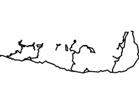
Riverflows vectorized upon a 1:25000 military topographic map in the area of Osogovo mountains. The riverflows are ranked in main, secondary etc. Some pf them have names. Created in the framework of the project Balkan Green Belt in Osogovo.
Datasets joins three single layers - High conservation value areas for butterflies (Lepidoptera) - by Stoyan Beshkov, ground beetles (Carabidae) by Borislav Georgiev and grasshoppers (Orthoptera) by Dragan Chobanov. Joined for the purposes of quicker wms. Created in the course of the project Balkan Green Belt in Osogovo. t provided
Points showing the locations of touristic information boards constructed by BBF in the course of the project "Conservation of the globally important biodiversity of Belasitsa Mountain through involvement of the local people in the developement of the ecotourism" with the financial aid of the Swiss Agency for Developement and Cooperation and the GEF Small Grants Programme.
The identified and marked touristic routes in the Bulgarian part of the Belasitsa Mountain during the course of the project "Conservation of the globally important biodiversity of Belasitsa Mountain through involvement of the local people in the developement of the ecotourism" with the financial aid of the Swiss Agency for Developement and Cooperation and the GEF Small Grants Programme.
Points showing the main peaks of Belasitsa Mountains, their names and altitude. The datasets contains also points in Greece and Macedonia and the neighbouring Ograzhden Mountain. Extracted from ZEM files, property of Ministry of Agriculture with added field GPS Points.