The file contains a part of the digitalised vegetation map of Bulgaria by Bondev, I. (1991): The vegetation of Bulgaria. Map in scale М 1:600 000 with explanatory text
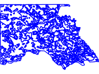
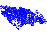
The file contains information about rivers (divided in main and secondary) in the territory of Strandja Nature park according the data from the preliminary management plan for Strandja Nature Park in 2005.
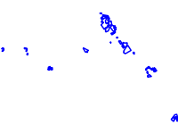
The data contains data for monitoring points of Vascular plants in the region of protected zones Strandja, Bosna and Derventski vazvishenia 2. The data is a part of an expert report within activity 2 – Development of a GIS database and of a monitoring system for the biodiversity and the social-economic characteristics for project Cooperation for biodiversity conservation and sustainable local development in Strandja Mountain № BG0061-GAE-00104-E-V1–EEA, funded by FM of EEA and implemented by the Bulgarian Biodiversity Foundation.