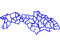
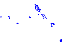
The data contains information for overgrowth of vegetation in open areas (abandoned once used fields, pastures and meadows) in protected zones Strandja, Bosna and Derventski vazvishenia 2 during the years 2006-2010
The data contains information for the tendency in changes in agricultural areas for the protected zones of Strandja, Bosna and Derventski vazvishenia 2